run.gpx · 27 lines
<?xml version="1.0" encoding="UTF-8"?>
<gpx version="1.1" creator="coffee-run" xmlns="http://www.topografix.com/GPX/1/1">
<trk><name>COFFEE</name>
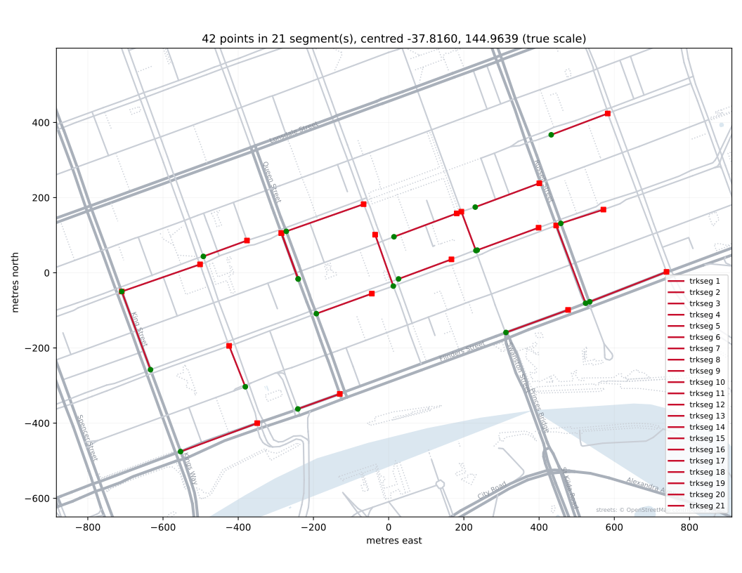
<trkseg><trkpt lat="-37.820240" lon="144.957580"/><trkpt lat="-37.819560" lon="144.959900"/></trkseg>
<trkseg><trkpt lat="-37.818280" lon="144.956670"/><trkpt lat="-37.816410" lon="144.955800"/></trkseg>
<trkseg><trkpt lat="-37.816410" lon="144.955800"/><trkpt lat="-37.815760" lon="144.958170"/></trkseg>
<trkseg><trkpt lat="-37.819220" lon="144.961130"/><trkpt lat="-37.818860" lon="144.962400"/></trkseg>
<trkseg><trkpt lat="-37.818690" lon="144.959540"/><trkpt lat="-37.817710" lon="144.959050"/></trkseg>
<trkseg><trkpt lat="-37.815570" lon="144.958270"/><trkpt lat="-37.815190" lon="144.959590"/></trkseg>
<trkseg><trkpt lat="-37.816110" lon="144.961140"/><trkpt lat="-37.815011" lon="144.960632"/></trkseg>
<trkseg><trkpt lat="-37.816110" lon="144.961140"/><trkpt lat="-37.815011" lon="144.960632"/></trkseg>
<trkseg><trkpt lat="-37.814970" lon="144.960780"/><trkpt lat="-37.814320" lon="144.963120"/></trkseg>
<trkseg><trkpt lat="-37.816940" lon="144.961690"/><trkpt lat="-37.816460" lon="144.963370"/></trkseg>
<trkseg><trkpt lat="-37.816280" lon="144.964020"/><trkpt lat="-37.815050" lon="144.963470"/></trkseg>
<trkseg><trkpt lat="-37.815100" lon="144.964040"/><trkpt lat="-37.814540" lon="144.965940"/></trkseg>
<trkseg><trkpt lat="-37.816109" lon="144.964179"/><trkpt lat="-37.815640" lon="144.965780"/></trkseg>
<trkseg><trkpt lat="-37.815430" lon="144.966520"/><trkpt lat="-37.814500" lon="144.966080"/></trkseg>
<trkseg><trkpt lat="-37.814390" lon="144.966500"/><trkpt lat="-37.813820" lon="144.968440"/></trkseg>
<trkseg><trkpt lat="-37.815420" lon="144.966560"/><trkpt lat="-37.814883" lon="144.968417"/></trkseg>
<trkseg><trkpt lat="-37.817390" lon="144.967430"/><trkpt lat="-37.816850" lon="144.969310"/></trkseg>
<trkseg><trkpt lat="-37.816690" lon="144.969840"/><trkpt lat="-37.814830" lon="144.968950"/></trkseg>
<trkseg><trkpt lat="-37.812660" lon="144.968800"/><trkpt lat="-37.812150" lon="144.970510"/></trkseg>
<trkseg><trkpt lat="-37.814780" lon="144.969091"/><trkpt lat="-37.814450" lon="144.970380"/></trkseg>
<trkseg><trkpt lat="-37.816655" lon="144.969967"/><trkpt lat="-37.815940" lon="144.972290"/></trkseg>
</trk>
</gpx>
round 1 of 8
Twenty-one separate pieces of street, each one a stroke, with nothing joining them into a run.
modelz-ai/glm-5.3-flashxtaskgpx-coffee-run@v2date2026-09-21rounds8 of 8 allowedcost$0.1063thinkingmediumtokens776,707 in, 24,769 out, of which 15,391 reasoningtime5 min 43 sfailurephysical-plausibility
On real streetsdecided by a number, from the filepass
One continuous routedecided by a number, from the filefail
Inside the griddecided by a number, from the filepass
Metadata truedecided by looking · Pass if every street the file's description names is one the trace runs along for at least a block, read off the map under the trace. One named street the route never uses fails it.pass
Reads as COFFEEdecided by looking · Pass if the six letters can be read off the plotted trace in order, by someone not told the word first. In practice that someone is me, and I knew the word, which is the weakness of this check.fail
There is no post about this one, since only some results need one, so the picture, the source and the scoring are here instead.
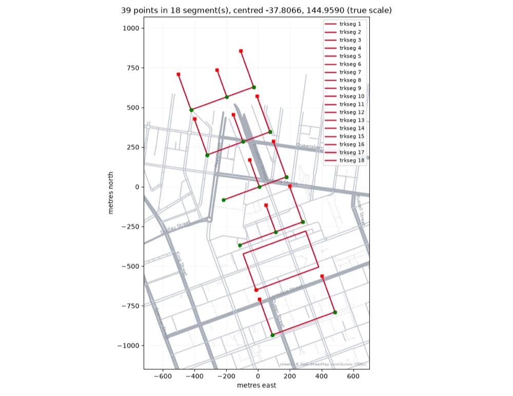
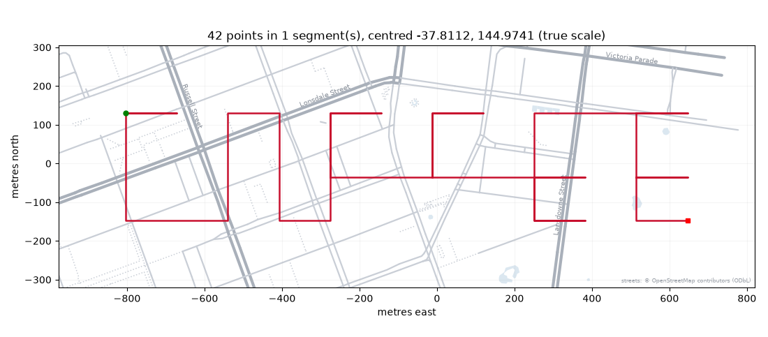 run 1 · 1r · $0.0140Drawn north-up across the blocks and out of the grid entirely, and still not readable as COFFEE.
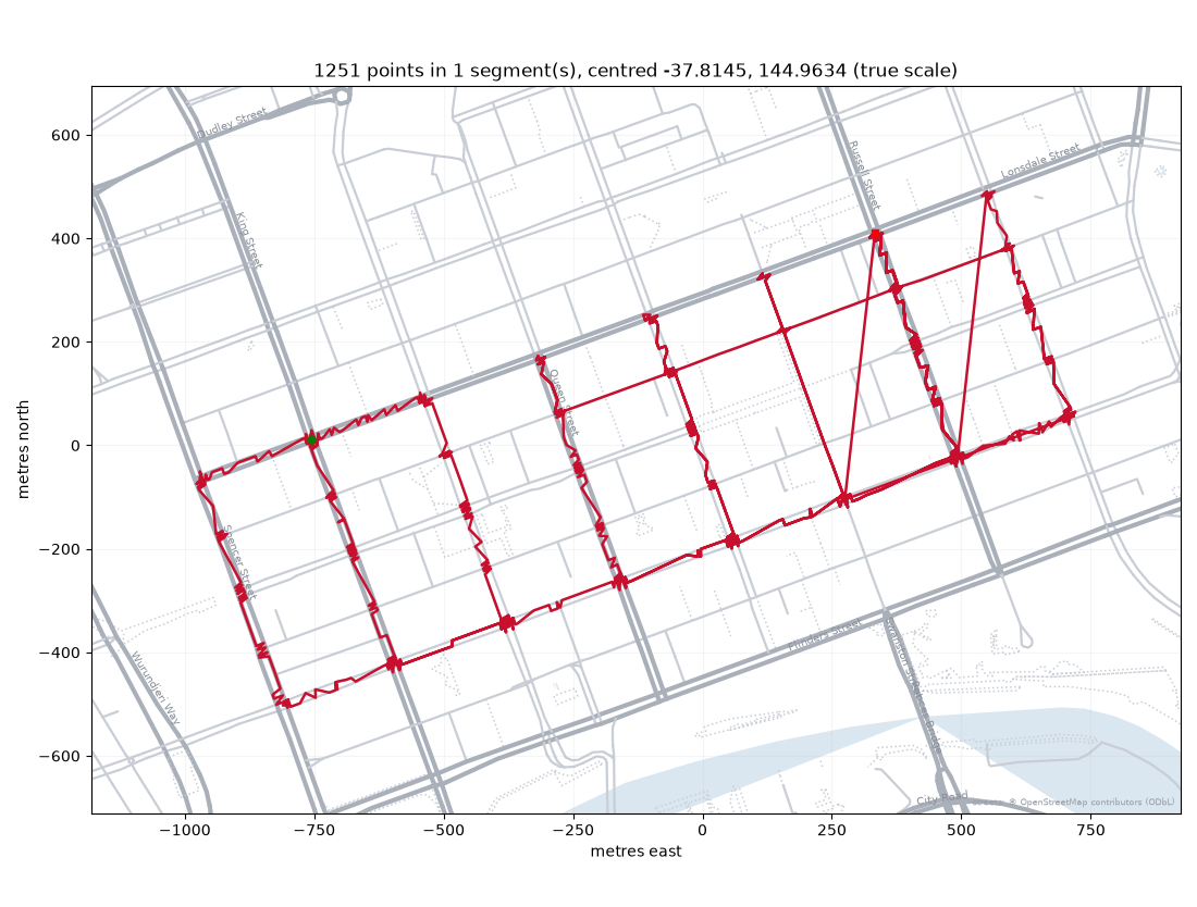 run 1 · 8r · $0.246720.5 km of boxes, with two diagonals cut straight across the blocks, and no word.
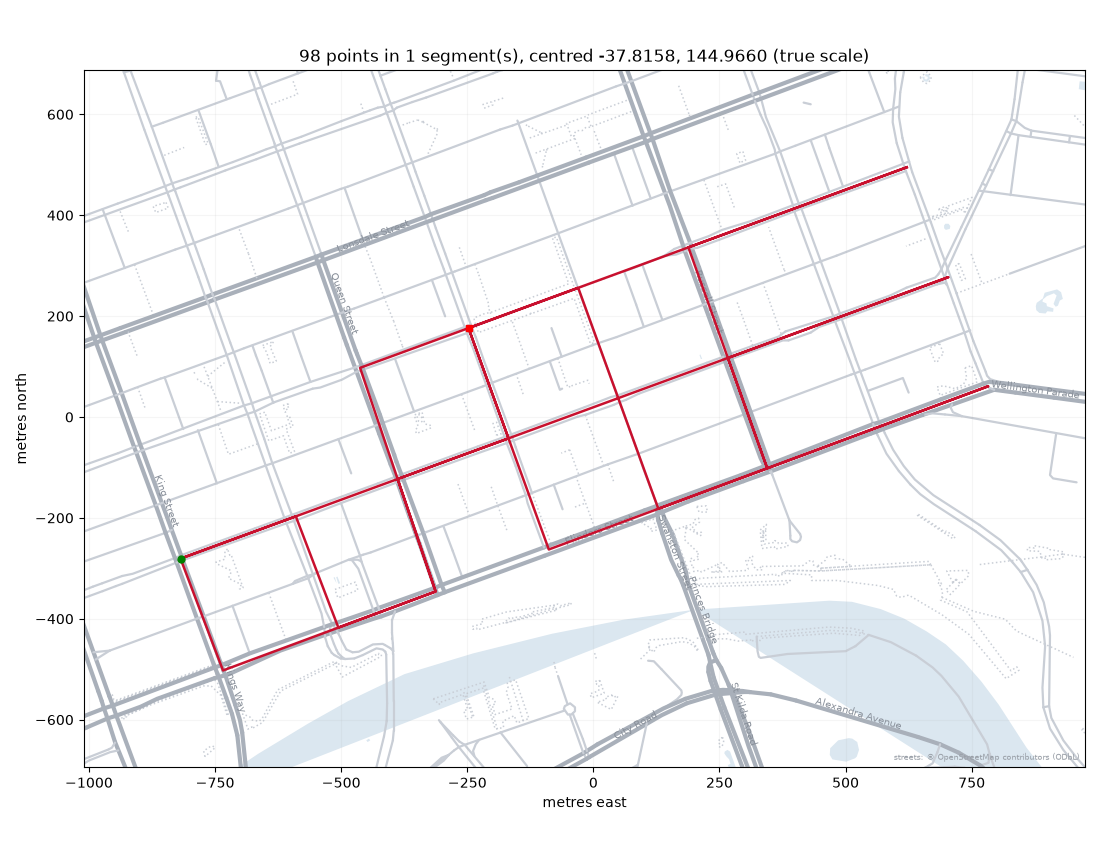 run 2 · 8r · $0.18909.7 km, every leg on a street, and a lattice of blocks where the letters should be.
same prompt, other modelsall 6 runs on A run that spells COFFEE →
Write a GPX file for a running route through Melbourne's CBD whose GPS trace spells COFFEE. It has to be a route someone could actually run: along the streets, not through the buildings.Frozen at v2. This model got this and nothing else.
An OpenStreetMap extract of the Hoddle Grid (streets and water, ODbL, taken 2026-09-16), the same one the harness ships for rendering. Every track point is measured to the nearest street centreline. How it is scored, and this run's files on GitHub.